
China - map
280. No Binding. Handcoloured map of China. c 1760-70. 18cm x 22.5cm (with mounting 27cm x 30.5cm).By Thomas Jeffrys, the leading cartographer in London for George III. Rare.
280. No Binding. Handcoloured map of China. c 1760-70. 18cm x 22.5cm (with mounting 27cm x 30.5cm).By Thomas Jeffrys, the leading cartographer in London for George III. Rare.
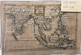
1777. Unbound. c 1777. An early hand-coloured engraved map, showing the East Indies as it was, including India, Ceylon, Mogul's Empire, Within and Beyond the Ganges, Siam, Malacca, Sumatra, Phillipine Islands, Borneo, Java, Celebes, New Guinea. A name plate at top is coloured gold. Height: 205 mm Width: 295 mm.....
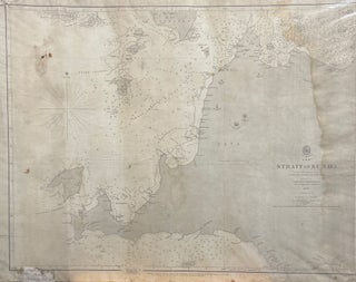
1857. No Binding. Original nautical chart showing the straits around Sumatra, Krakatoa. 52 x 69 cm. Some staining and small holes where paper has perished a little, not affecting any text.
London: G.G. & J. Robinson, 1787. NEELE (engr). Unbound. Engraved by S. Neele sculpt. 352 Strand. No. 52. Original colour engraving. Size: 530mm x 415mm. Free-floating & protected by mylar. A handsome map.

London: J Cary, 1799. CARY, J. Unbound. Large orig coloured engraved composit map of the Russian Empire.(on 2 sheets joined at back, the numbers 37 and 38 pasted on versos.On heavy cloth. Size: 1135mm x 550mm. A very attractive map.
Auckland: 1862. Unbound. Image size 235x160mm, including margin 265x195. John Dower, FRGS from Illustrated London News, November 8 1863. Shows forts, battery & placement of ships. A hand coloured map kept in excellent condition.
London: G.G. & J. Robinson. 1799. NEELE (engr). Unbound. Early, orig engraved map showing the anchorage of the L'Astrolabe and La Boussole at the Bay on the west shore of Sakalin Island, Russia. Free floating & protected by mylar. Full size: 295mm x 465mm. A very nice map.
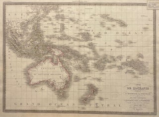
Paris: Chez Eymery Fruger, 1829. Unbound. Engraved map with coloured outlines. Size of map 393mm x 543mm, size of full sheet 485mm x 612mm. A rare example of an early hand-coloured French map.
1805. No Binding. (c.1805 - Post Flinders). Original hand-coloured map of Asia. Small tears & creases at extremities of margins, shows New Holland (Australia) and Turkish, Russian, Chinese etc Dominions.
London: The London Magazine, 1745. No Binding. Image Size: 230x170mm, Overall Size: 270x210mm. 2 folds. Published in 'The London Magazine'. A very good, interesting engraved map with original hand-colouring, showing Tschirkow's & Bering's routes.
USA: Public Affairs. paperback. In Destiny Disrupted, Tamim Ansary tells the rich story of world history as it looks from a new perspective: with the evolution of the Muslim community at the center. His story moves from the lifetime of Mohammed through a succession of far-flung empires, to the tangle.....