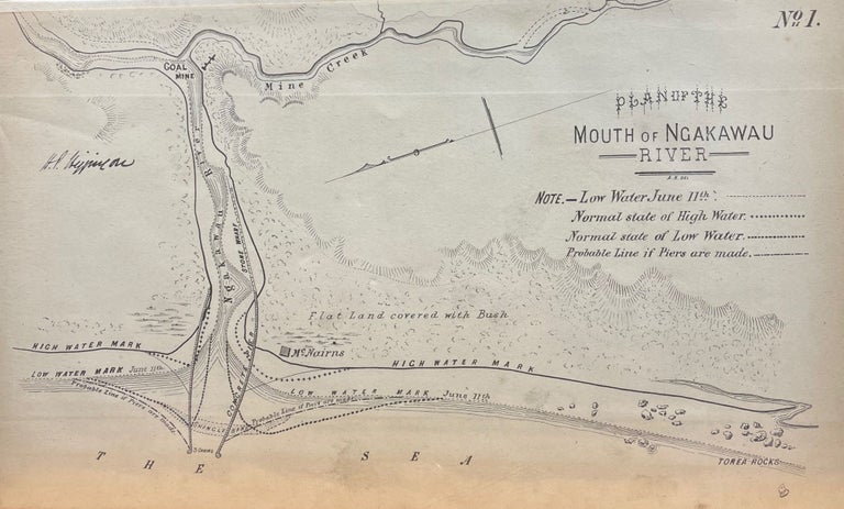
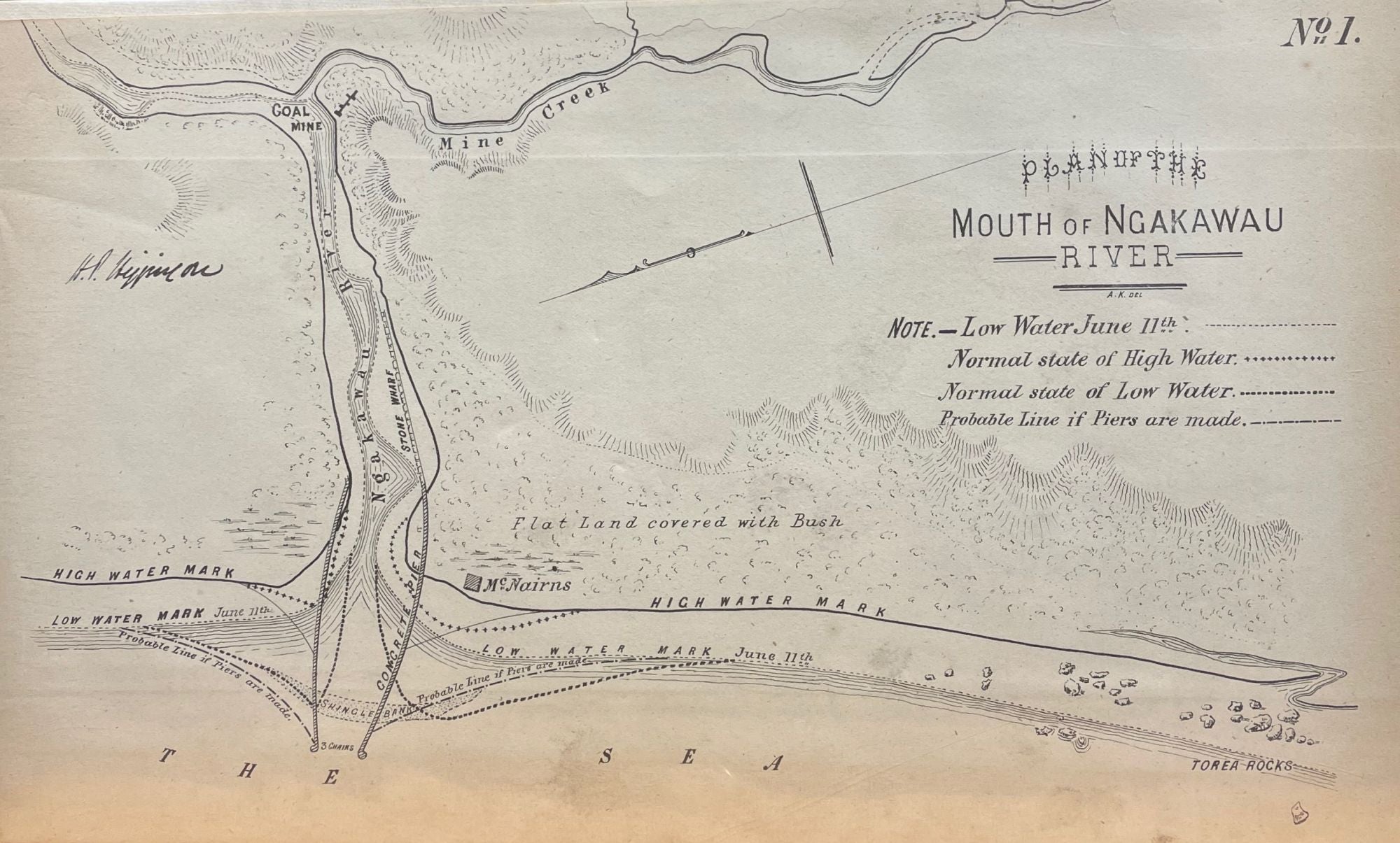
Plan of The Mouth of Ngakawau River - Line Map
Unbound. Line map of mouth of the Ngakawau on New Zealand's South Island west coast. c. 1870. Size 320mm x 194mm x 320mm. Showing the high and low water marks and McNairns. Rare. 0. Very Good, Item #13078
Price: $23.28
See all items in
Maps,
New Zealand