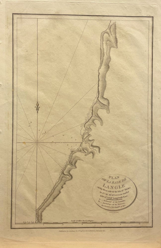
Plan of la Baie de Langle on the West side of the Isle of Tchoka Map
London: G.G. & J. Robinson. 1799. NEELE (engr). Unbound. Early, orig engraved map showing the anchorage of the L'Astrolabe and La Boussole at the Bay on the west shore of Sakalin Island, Russia. Free floating & protected by mylar. Full size: 295mm x 465mm. A very nice map. Very Good. Item #15074
Price: $138.00
See all items in
Maps
See all items by Jean-Francois De Galaup LA PEROUSE