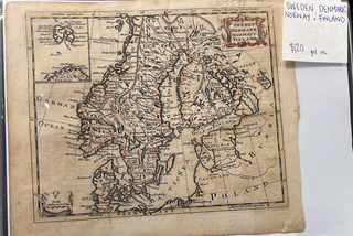
Sweden, Denmark, Norway and Finland Map
1777. Unbound. c 1777. An early hand-coloured engraved map, showing Arctic Circle, East Greenland, Swedish Lapland and Gothland; Norway's ports along the German Ocean; Finland's borders with Sweden and Russia and Gulf of Finland; Denmark and Jutland. An illustrated name plate at top right is rose-coloured. Minor wear at edges.....