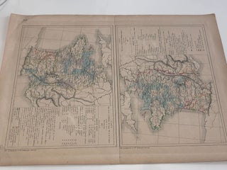
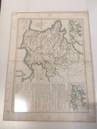
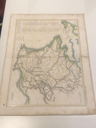
ATLAS GENERAL par L. DUSSIEUX . page 46
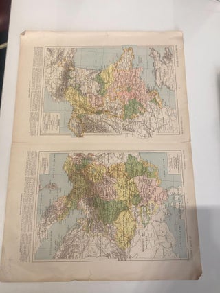
1852. No binding. Two maps from ATLAS GENERAL par L. DUSSIEUX, on page 46.
1852. No binding. Two maps from ATLAS GENERAL par L. DUSSIEUX, on page 46.
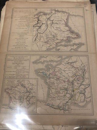
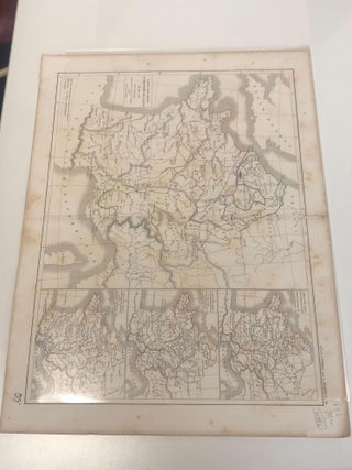
Paris: Jacques Lecoffre et Comp. 1853. No binding. Two maps related to the topic of mining in France, 1853.
No binding.
London: Laurie & Whittle, 1794. Unbound. c. 1840. Orig coloured engraving of Belgium & The Netherlands from Thomson's New General Atlas. Size: 720mm x 535mm. Free-floating & protected by mylar. A very nice map.
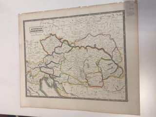
1851. No binding.
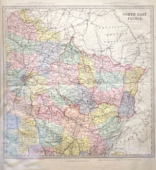
1845. No binding.
1852. No binding.

280. No Binding. Handcoloured map of China. c 1760-70. 18cm x 22.5cm (with mounting 27cm x 30.5cm).By Thomas Jeffrys, the leading cartographer in London for George III. Rare.
Auckland: 1782. Unbound. Showing Europe, Africa Asia and Australia. Diameter of Globe 180mm. German. Excellent condition. Paper size 250x215, centre fold. Original hand-coloured map, interesting & attractive German language map showing Cook's route. Key in German.

No binding. A map of Denmark with colours, no date.
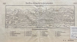
No Binding. B&W engraving showing a plant of the city of Montpellier and its prospects or surroundings. Contains a key denoting particular features of the city including gates, streets and major buildings. c1650. Free sheet in protective plastic.
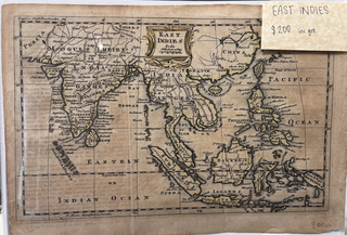
1777. Unbound. c 1777. An early hand-coloured engraved map, showing the East Indies as it was, including India, Ceylon, Mogul's Empire, Within and Beyond the Ganges, Siam, Malacca, Sumatra, Phillipine Islands, Borneo, Java, Celebes, New Guinea. A name plate at top is coloured gold. Height: 205 mm Width: 295 mm.....

London: Sayer, 1777. Quarter Vellum. 47 of 50 maps (lacks 1-3). Bound in original quarter vellum and boards. Worn. An interesting and rare collection of maps of England and Wales.
Paris: 1811. No binding. A map of Empire Francais.
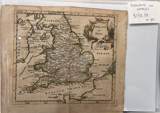
1777. Unbound. c 1777. An early hand-coloured engraved map. Shows England and Wales with counties and towns, the Irish Sea, English Channel and "German Ocean". Illustrated name plate at top right shows the lion, a tree and a ship's mast. Minor tear at the bottom of a fold but else.....
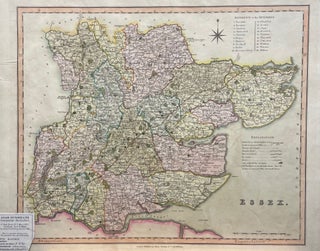
London: Henry Teesdale. Unbound. c. 1830. Orig hand-coloured engraved map of the county of Essex with key to symbols and a reference to the Hundreds. Size: 467mm x 375mm. Free-floating & protected by mylar. A very handsome map. 0.
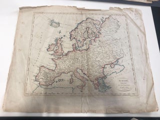
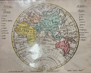
1787. No binding. A map of Europe.
Paris: 1867. Unbound. Original hand-coloured circular engraved French map of the South Pole showing Lambert's route. With 4 insert showing: Route de l'expe??dition franc??aise, projection e??toile??e du Dr. Jaeger, Regions polaires australes, Marche?? suppose??e du po^le magne??tique & Courbes de moyennes d'insolation au 21 juin. Free-floating & protected with mylar.....
No binding. Four maps combines in one, no date.
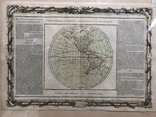
Paris: Desnos. No Binding. c 1760. Shows the Americas and tracks of explorers. NZ is shown as Tasman saw it. "Hemisphere Occidental". Original hand-colour.
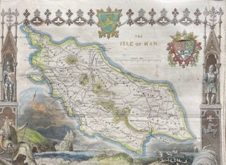
No Binding. Hand-coloured engraving, 22 x 26 cm within larger mount. c 1840. The map surrounded by decorative and symbolic images.
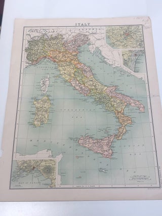
1900. No binding. A map of Italy.
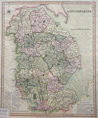
London: Henry Teesdale, 1830. Unbound. c1830. Original hand-coloured engraved map of the county of Lincolnshire with key to symbols and a reference to the Hundreds. Size: 377mm x 470mm. Free-floating & protected by mylar. A very handsome map.
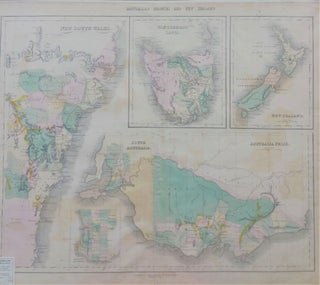
Edinburgh: Gallingis. No Binding. In five parts showing details of NSW, Van Diemen's land, NZ, W. Australia and S. Australia. c.1851.
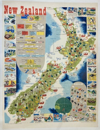
1951. Mallitte, H. Unbound. 1951. 32.5'' x 42'' / 83 x 107 cm. Lithograph. Backed on Linen. Printed by R.E. Owen, Government Printer, Wellington, NZ. Produced by Publicity Division, Department of Tourist and Publicity, N.Z. Government. Excellent condition. Rare item.